


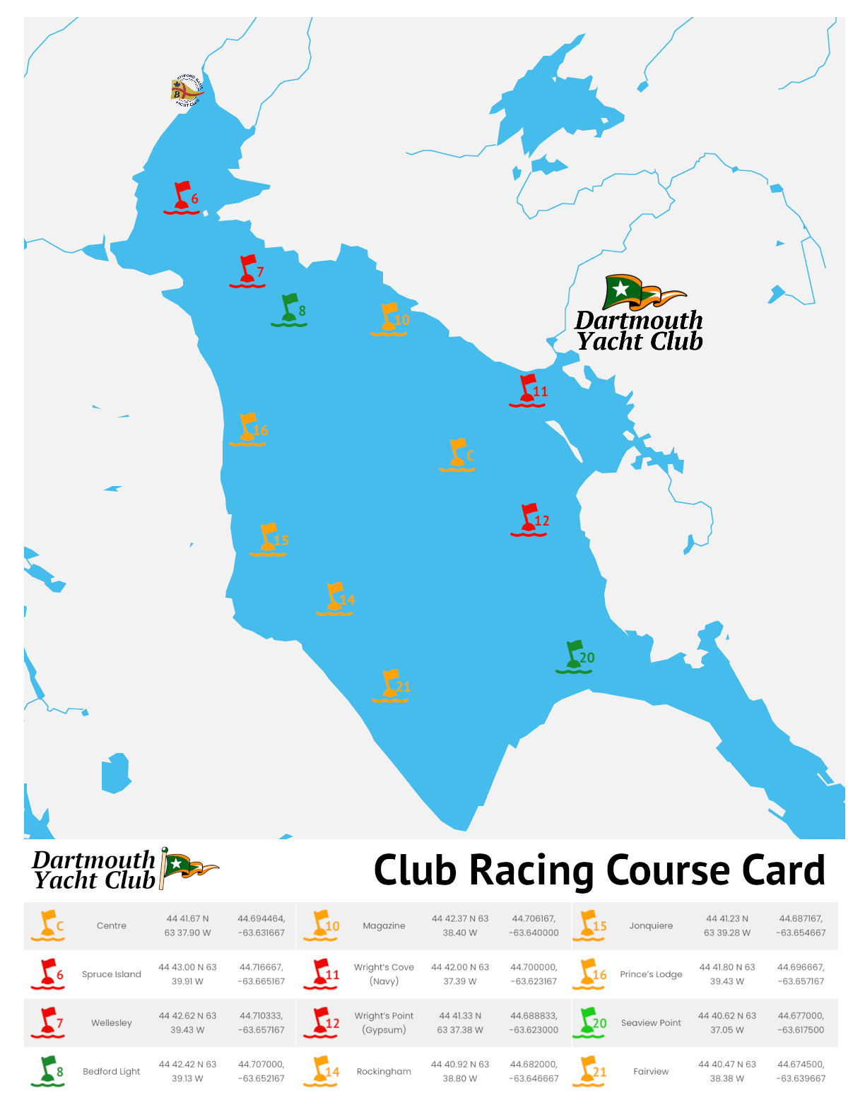
Basic
Course Card
Save and print in full colour, this is our newly updated course card for 2024. A handy quick reference for sailors.
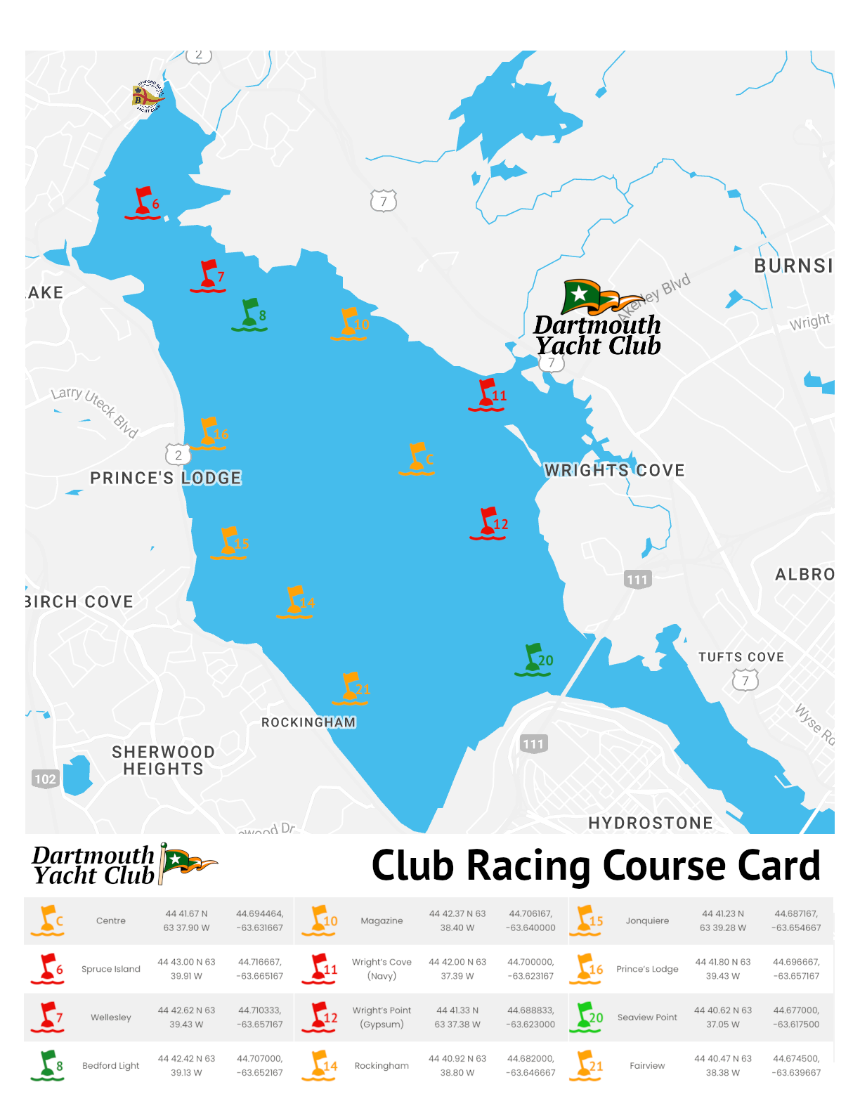
Enhanced
Course Card
The ultimate course card featuring landmarks, labels, headings and distances.

Classic
Course Card
Printable in black and white or colour. This is the course card you know and love. Mark chart includes colour name.
Interactive Course Map
| Mark | Name | Coordinates | Decimal |
|---|---|---|---|
 | Centre | 44 41.67 N 63 37.90 W | 44.694464, -63.631667 |
 | Spruce Island | 44 43.00 N 63 39.91 W | 44.716667, -63.665167 |
 | Wellesley | 44 42.62 N 63 39.43 W | 44.710333, -63.657167 |
 | Bedford Light | 44 42.42 N 63 39.13 W | 44.707000, -63.652167 |
 | Magazine | 44 42.37 N 63 38.40 W | 44.706167, -63.640000 |
 | Wright’s Cove (Navy) | 44 42.00 N 63 37.39 W | 44.700000, -63.623167 |
 | Wright’s Point (Gypsum) | 44 41.33 N 63 37.38 W | 44.688833, -63.623000 |
 | Rockingham | 44 40.92 N 63 38.80 W | 44.682000, -63.646667 |
 | Jonquiere | 44 41.23 N 63 39.28 W | 44.687167, -63.654667 |
 | Prince’s Lodge | 44 41.80 N 63 39.43 W | 44.696667, -63.657167 |
 | Seaview Point | 44 40.62 N 63 37.05 W | 44.677000, -63.617500 |
 | Fairview | 44 40.47 N 63 38.38 W | 44.674500, -63.639667 |
Not for navigational use